Open Tree Map - Bengaluru
An initiative by Gubbi Labs.
Method 1: Mapping Application
You will need:
- A smart phone / laptop
- A datapack / working Internet connection
- Measuring tape (optional)
STEPS:
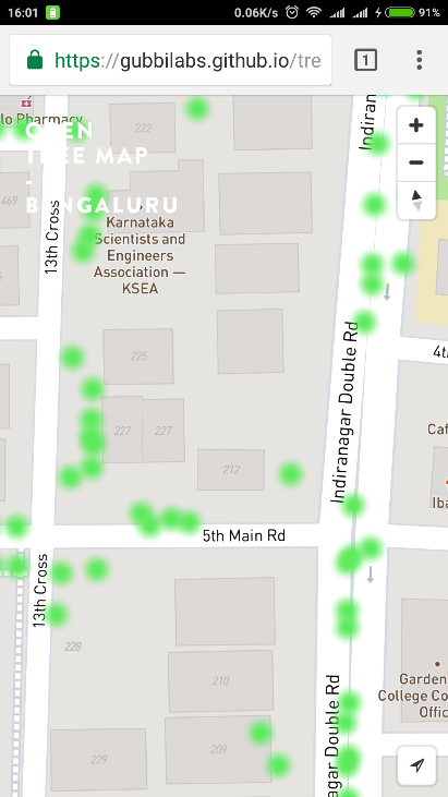
- One can use two key base maps: OSM Streets or Mapbox Satellite. Open the link on the browser of your phone/laptop. Map using OSM Streets Map using Mapbox Satellite
- Click on the 'location' icon at the bottom right corner of the screen. This will show your location on the map.
- Click on any point on the map to add a tree.
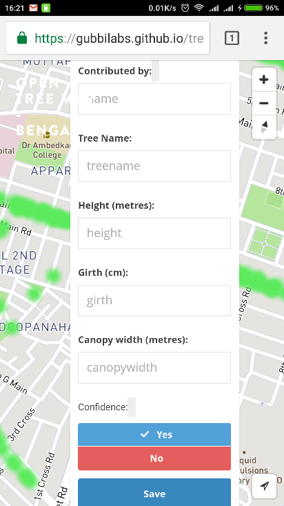
- Fill in the details (optional)
- Tree name: Enter the scientific/common name of the tree. You can find some resources on tree identification here.
- Height (m): There are several methods which can be used to approximately measure the height of a tree. This is one of them: Make a person stand next to the tree and move back such that you can view the entire tree - top to bottom. Hold a pen at arm’s length such that it appears to exactly cover the person. Estimate how many lengths of the pen it takes to cover the height of the tree. This number multiplied by the height of the person will give the approximate height of the tree.
- Girth (cm): The girth (circumference of the trunk) should be measured at a height of 1.37m above the ground. In case of multi-trunk trees, the circumference of each trunk should be measured separately.
- Canopy width (m): Measure the longest spread and longest cross spread of the canopy.
- Confidence: How confident are you on the identification of this tree?
- Click on ‘Save’ to update the tree on the map.
Note: The application is open source. You can edit the code and use it to make your own mapping tool.